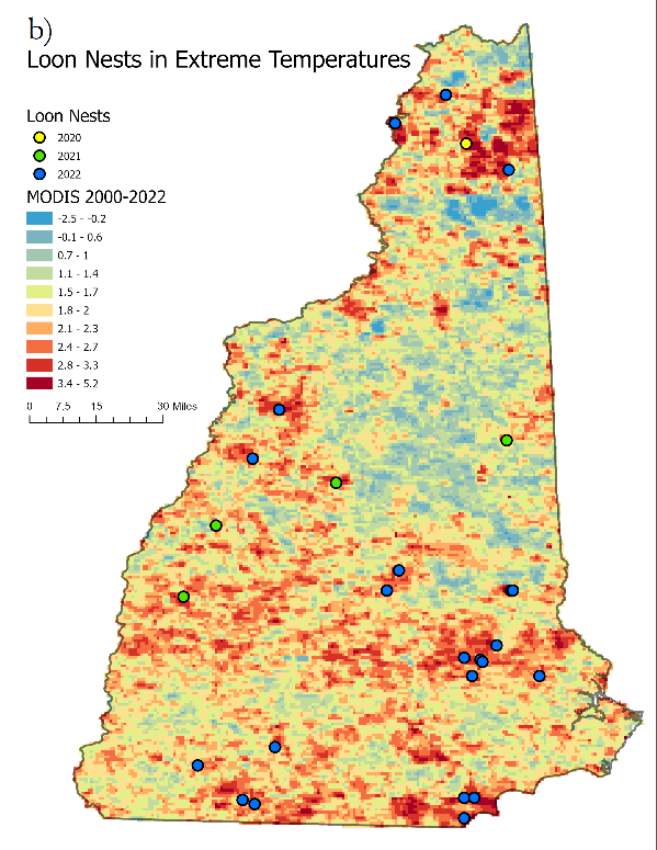
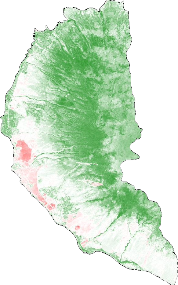
My team and I coordinated with the Loon Preservation Committee to develop an analysis of future Common loon breeding habitat and potential conflict with human development. When analyzing land surface temperature change, I found that most loons have still kept their nest sites, suggesting that they haven't reached an extreme temperature threshold yet.
NASA DEVELOP Technical PaperTo read more:
Predicting Future Loon Habitat in New HampshireAssessing Forest Cover Change in Mesoamerica
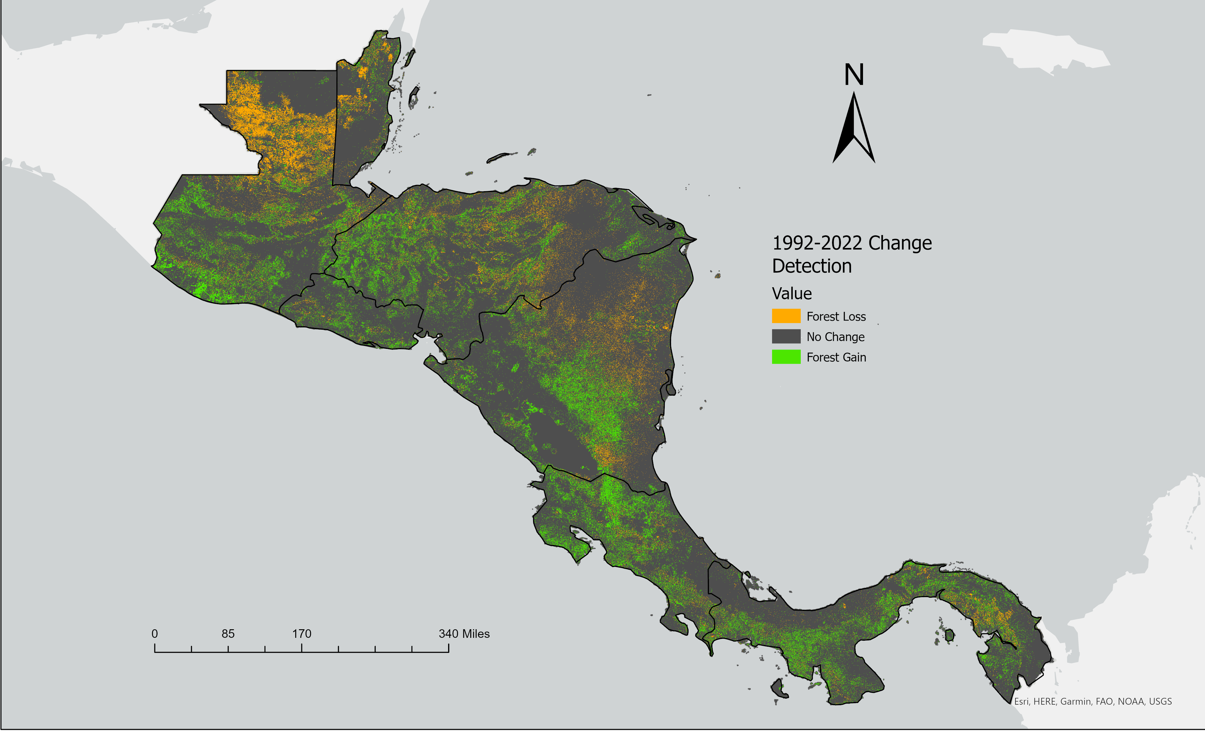
I worked on a project to conduct an analysis of forest cover change in the Mesoamerican Biological Cooridor. We developed binary image classification model to assess Landsat imagery going back thirty years. We found that there 6.18% overall decrease of forested areas in the study area, and a 10.9% increase of forested areas.
NASA DEVELOP Technical PaperTo read more:
Assessing Forest Cover Change in Mesoamerica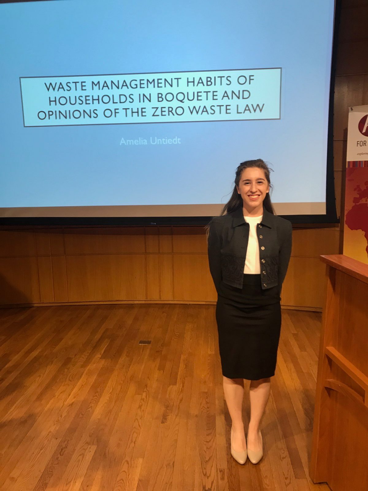
I designed and led a research project on waste management habits and the relationships between waste management and global development. I conducted interviews on waste management habits and the new Single Use Plastic ban with Panamanian households and foreign households living in Boquete, Panama and found that habitats are influenced by country and culture of origin.
To read more:
Waste Management Habits of Households in Boquete, Panama
I made a series of maps of the LA Wildfires looking at Normalized Burn Ratio and Normalized Difference Moisture Index conditions leading up to the fire as well as total area burnt. I also analyzed past climate trends as well as the impact of the Santa Ana winds in the area.
2025 LA Wildfire AnalysisTo read more:
LA Wildfire AnalysisMaui Wildfire
I conducted a series of analyses on the 2023 Maui Wildfires using a normalized burn ratio (NBR), normalized difference moisture index (MDMI), and a normalized difference vegetation index (NDVI) looking at both before and after the wildfire.
Maui Wildfire Google Earth Engine AppTo read more:
Maui Wildfire Analysis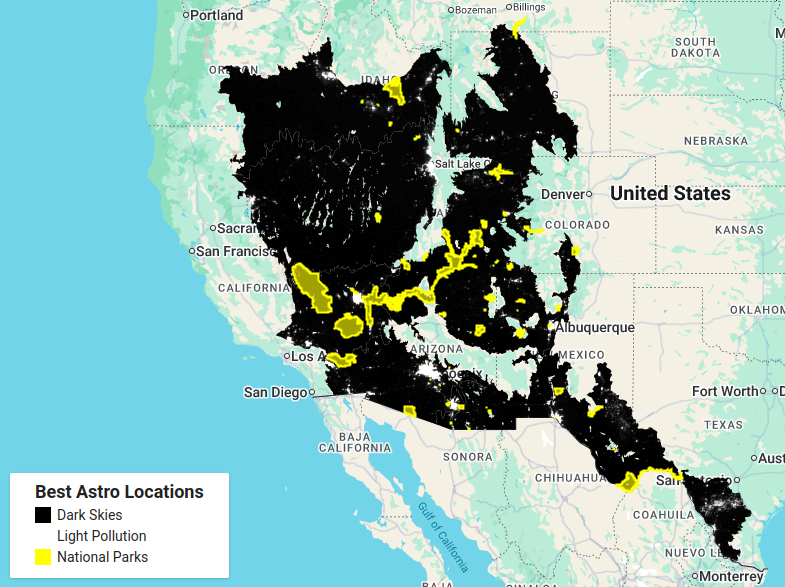
Using Google Earth Engine, I created a map of the best locations in desert and xeric shrubland for astrophotography in the southwest of the Untied States.
To read more:
Light Pollution Analysis for Astrophotography