Assessing Land Cover Change and Habitat Connectivity to Inform Management Planning for the Mesoamerican Biological Corridor
I worked within a team of four researchers assessing forest cover change from 1984 to 2022 using Landsat satellite series to support international policy and decision makers in the Mesoamerican Biological Corridor (MBC). My team partnered with NASA SERVIR, Sistema de la Integracion Centroamericana (SICA), Tropical Agriculture Research and High Education Center (CATIE), and the Ministries of the Environment for Costa Rica, El Salvador, and Guatemala. This study evaluated forest cover change in Mesoamerica, excluding Mexico.
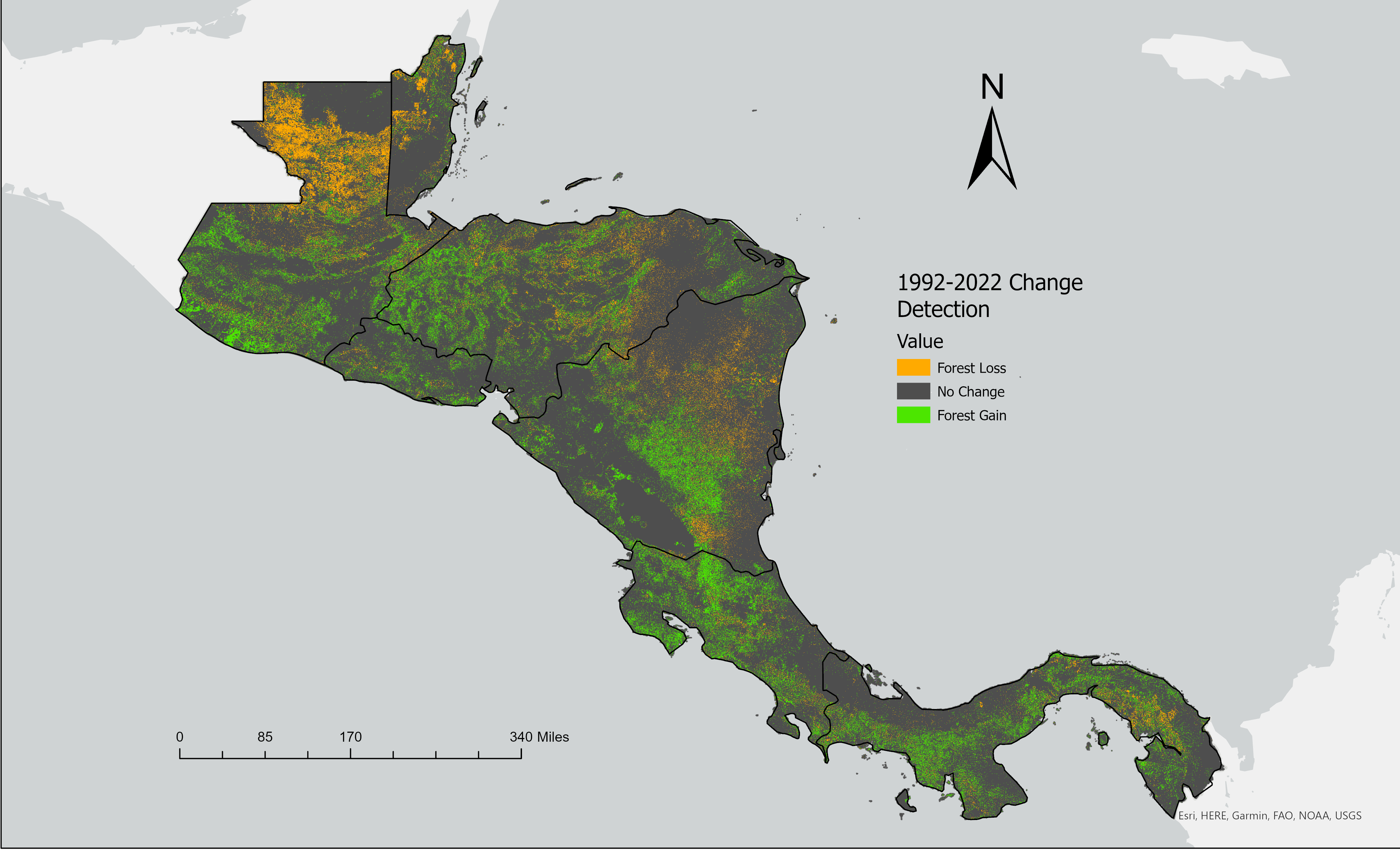
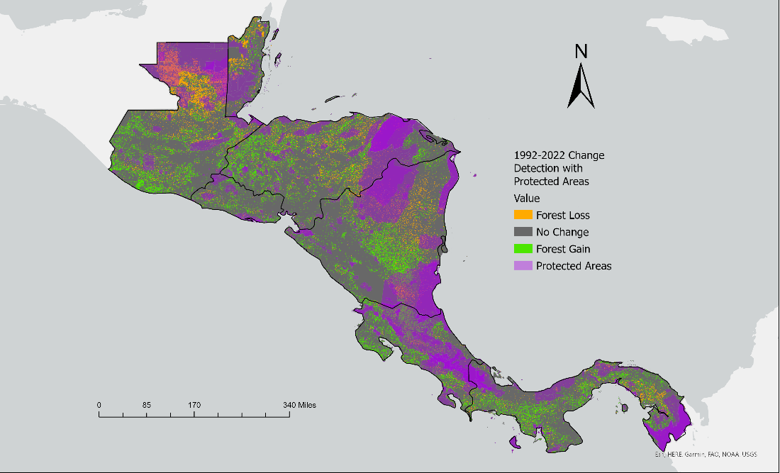
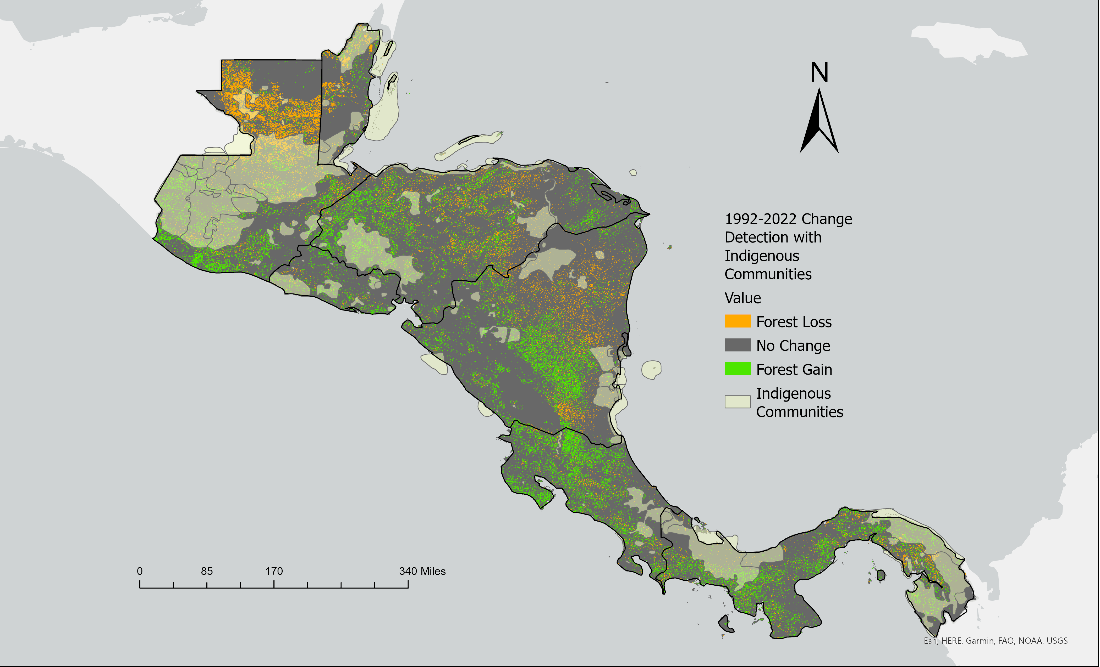
In Google Earth Engine (GEE), we acquired mosaiced, cloud free images from Landsat 5, 7, 8, and 9 at 100m resolution. We then created a binary classification of forest versus nonforest using the Minimum Distance classifier. We decided to use the Minimum Distance classifier over Random Forest because it resulted in a more accurate and less grainy classification. Data layers for protected areas and indigenous communities were also collected. The data was exported to ArcGIS Pro, where we conducted a change detection analysis using the Raster Calculator. This tool calculates the temporal change by tracking changes in pixel values. We calculated the change from 2022 to 1992, as well as 10 year intervals at 1992, 2002, 2012, and 2022.
The 1992-2022 change detection analysis showed a 6.18% change to forest loss and a 10.99% change to forest growth. Forest gain was higher than expected. This study was unable to determine the difference in spectral signatures between native forest or agricultural forest. It is very likely that palm oil production was misclassified as forest growth. When looking at forest cover change in protected areas, the team found little or no change in forest cover, suggesting that protected areas are benefitting from effective management, though some of these protected areas are isolated and harder to access. When looking at forest cover change within the indigenous community layers, there was also little to no change.