Light Pollution Analysis for Astrophotography
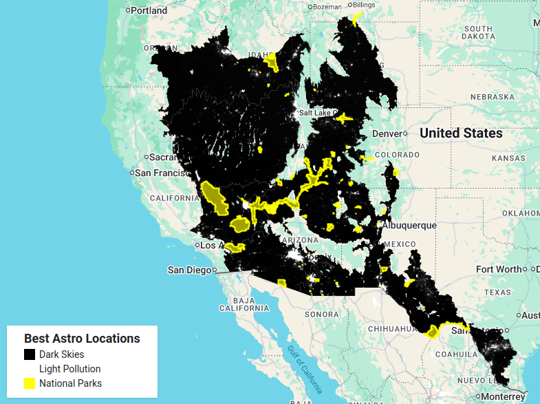
At the request of a photographer friend of mine, I created a map of the best locations in desert and xeric shrubland for astrophotography in the southwest of the United States. Using Google Earth Engine, I filtered the ecoregion layer to desert and xeric shrubland. I imported the DMSP OLS: Nighttime Lights Time series layer to identify areas with dark skies. I also imported a national parks layer to show dark skies areas in national parks. All of this together created a simple map for astrophotography in desert and xeric shrubland.